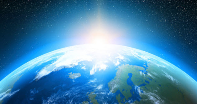
Earth looks permanent when viewed from the backyard. Mountains appear nailed down, coastlines seem confidently outlined, and deserts behave as though they signed very long leases. In reality, our planet is a restless construction site where continents drift, oceans circulate, ice sheets expand and retreat, and tiny orbital changes can reorganize climate over thousands of years.
That makes geographical “what if” scenarios more than entertaining science fiction. They reveal how strongly topography, ocean gateways, axial tilt, vegetation, and ice affect temperature, rainfall, ecosystems, and human civilization. Change one major feature, and the consequences can spread around the globe like someone knocked over the first domino without checking how many were behind it.
The following scenarios are science-based thought experiments rather than forecasts. They simplify immensely complicated Earth systems, but each begins with processes scientists already observe in geology, oceanography, atmospheric science, and paleoclimatology.
1. What If the Continents Had Never Moved?
Plate tectonics constantly rearranges Earth’s surface. The planet’s outer layer is divided into moving plates that create ocean basins, volcanoes, trenches, earthquakes, and mountain ranges. The Himalayas, for example, began forming when India collided with Eurasia roughly 40 to 50 million years ago.
If the continents had remained fixed throughout Earth’s history, the modern world would barely be recognizable. There might be no Himalayas, Andes, Alps, or familiar Atlantic Ocean. Ocean circulation would follow different routes, affecting where heat and nutrients traveled. Animal evolution would also change because moving continents repeatedly connected and isolated ecosystems.
Human history would be rewritten before humans even appeared. No Himalayan barrier could mean a radically different Asian monsoon. Rivers such as the Ganges and Brahmaputra might not exist in their current forms. Fossil fuels, metal deposits, and fertile volcanic soils would occur in different placesor might never form at all.
In other words, the world map would not merely look unusual. The climate, food supply, biodiversity, and locations suitable for civilization would all be shuffled like an extremely high-stakes deck of cards.
2. What If All the Continents Formed One Supercontinent Today?
Earth has assembled and broken apart supercontinents in the past. If today’s continents suddenly joined into one enormous landmass, the coastline would shrink dramatically relative to the amount of interior land.
Coastal regions benefit from the ocean’s ability to absorb and release heat gradually. The center of a supercontinent would be far removed from that moderating influence. Summers could become brutally hot, winters intensely cold, and rainfall highly seasonal. Vast inland deserts would likely spread across areas too distant from major moisture sources.
Mountain belts created where continents collided could redirect winds and produce powerful rain shadows. Modern examples show how mountains force moist air upward, increasing precipitation on windward slopes while leaving drier conditions on the leeward side. Puerto Rico’s mountain ranges, for instance, help create a humid north and a significantly drier south.
Transportation would become strange as well. Overland trade might expand, but many interior communities would be thousands of miles from a seaport. Global politics could revolve around the relatively limited coastline, major rivers, and temperate margins. Beachfront property would become even more expensive, which is impressive considering how hard it is already to buy a sandwich near the ocean without taking out a small loan.
3. What If Earth Had No Major Mountains?
Mountains are atmospheric traffic directors. They interrupt winds, force air upward, redistribute precipitation, store snow and ice, feed rivers, and create habitats that change rapidly with elevation.
Without major mountain ranges, winds could travel across continents with fewer obstacles. Rainfall patterns would become more uniform in some regions, while places that depend on mountain-driven precipitation could become drier. Rain-shadow deserts such as those found east of the Sierra Nevada might shrink or disappear, but so could wet mountain forests that receive abundant orographic rainfall.
Major rivers would also change. Mountain snowpack acts as a natural reservoir, releasing water during warmer months. Without elevated snow and glaciers, river flow could become more dependent on immediate rainfall, making water supplies less predictable in seasonal climates.
There would be fewer high-altitude refuges for cold-adapted species. Soil erosion, river sediment, agriculture, and regional wind patterns would all respond. The planet might look smoother from space, but its climate would not necessarily become calmer. Earth would simply trade one set of complications for another, which appears to be one of nature’s favorite business models.
4. What If the Isthmus of Panama Had Never Formed?
The narrow land bridge connecting North and South America transformed global geography. By closing the marine connection between the Atlantic and Pacific, it rerouted ocean currents and influenced regional climate. It also created a biological highway that allowed species to move between the two continents.
If the gap had remained open, Pacific and Atlantic water could still exchange directly through Central America. Differences in salinity and circulation between the oceans would probably be smaller. The Atlantic circulation system might transport heat differently, potentially altering rainfall around the Caribbean, Europe, Africa, and the Americas.
Central America would consist of islands or separated landmasses rather than a continuous bridge. North and South American wildlife would have experienced less mixing. Animals that crossed between the continents during the Great American Biotic Interchange might never have made the trip.
Human transportation would benefit from a natural seaway instead of requiring the Panama Canal. Unfortunately, Panama itself would lose quite a lot of real estate, proving that even convenient shipping routes have awkward trade-offs.
5. What If the Atlantic Ocean’s Overturning Circulation Stopped?
The Atlantic Meridional Overturning Circulation, commonly called the AMOC, is part of the global ocean conveyor system. It carries heat, salt, carbon, nutrients, and water through the Atlantic, influencing climate, marine ecosystems, rainfall, and regional sea level.
A complete shutdown is an extreme hypothetical scenario, not something that should be described casually as an imminent certainty. However, imagining it demonstrates why ocean circulation matters.
Northwestern Europe could experience less ocean-delivered warmth, although the outcome would interact with ongoing global warming rather than simply creating an instant ice age. Rain belts could shift, tropical monsoons could weaken or relocate, and some storm tracks might change. Sea level could rise unevenly along parts of the North American Atlantic coast because ocean circulation helps shape regional sea-surface height.
Marine ecosystems would face disruptions in nutrient and oxygen transport. Fisheries could shift as water temperatures and food webs reorganized. The important lesson is that oceans are not giant decorative puddles. They are active components of Earth’s climate-control system, moving heat away from the tropics and reducing temperature extremes between low and high latitudes.
6. What If the Sahara Became Green Again?
The Sahara has not always been the enormous desert seen today. During the African Humid Period, stronger monsoon rainfall supported lakes, grasslands, rivers, wildlife, and human communities across parts of northern Africa. Orbital variations affected the distribution of sunlight and helped strengthen the North African monsoon.
If the Sahara became green again, vegetation would darken parts of the land surface, alter evaporation, reduce some dust emissions, and add moisture to the atmosphere. Lakes and wetlands could return to some basins. Habitable and agricultural zones might expand northward, although rainfall variability, soil quality, heat, and water management would still matter.
The effects would extend beyond Africa. Saharan dust regularly crosses the Atlantic, reaching the Caribbean and other regions. Reducing that dust could affect air quality, cloud formation, ocean nutrients, and ecosystems that currently receive mineral-rich particles from Africa.
A greener Sahara would not automatically become one giant farm. Ecosystems would require time to develop, rainfall would remain uneven, and political borders would not politely rearrange themselves around the new climate. Still, it would represent one of the most dramatic geographical transformations imaginable without moving a single continent.
7. What If Earth Had No Axial Tilt?
Earth’s axis is tilted by roughly 23 degrees relative to its orbit, producing the seasonal cycle as each hemisphere alternately leans toward and away from the Sun. Axial tilt naturally varies over long periods, with larger tilts generally producing stronger seasonal contrasts.
With no tilt, familiar seasons would largely disappear. The Sun’s average position would remain centered over the equator throughout the year. Equatorial regions would receive consistently strong sunlight, while the poles would remain cold and dim.
Permanent or extensive polar ice could become easier to maintain because polar summers would no longer provide months of relatively intense sunlight. Climate zones might become more fixed by latitude. Migratory behavior, planting seasons, hibernation, reproduction, and countless cultural traditions would change.
Midlatitude residents might enjoy more predictable temperatures, but “no seasons” would not mean identical weather every day. Storms, ocean cycles, droughts, and shorter-term atmospheric variations would continue. Weather would still find creative ways to ruin a picnic.
8. What If Earth’s Axial Tilt Increased to 45 Degrees?
A 45-degree tilt would create extreme seasons. During summer, each hemisphere would lean much more strongly toward the Sun. During winter, it would lean much farther away.
High-latitude summers could receive enormous amounts of daylight and solar energy, while winters would bring long darkness and severe cooling. Some polar areas might experience surprisingly warm summers, making year-round ice difficult to preserve. Meanwhile, continental interiors could endure extraordinary annual temperature swings.
Monsoon systems would likely intensify or shift because seasonal heating contrasts between land and ocean would grow. Ecosystems would need to tolerate hotter summers, colder winters, or migrate toward more moderate zones. Agriculture might depend on extremely short but productive growing seasons in some regions and become impractical in others.
Earth’s actual orbital cycles show that even relatively modest changes in tilt can influence long-term climate and the timing of ice ages. A sudden jump to 45 degrees would therefore be less like adjusting a thermostat and more like handing the thermostat to an enthusiastic toddler.
9. What If All Land Ice Melted?
If all glaciers and ice sheets on land melted, global average sea level would rise by approximately 230 feet, or 70 meters. The process would require enormous and sustained warming and would not happen overnight, but the final geography would be astonishing.
Many of today’s coastal cities, ports, river deltas, and low-lying islands would be submerged. Florida would lose much of its current shape. Coastlines would move inland around the Gulf of Mexico, eastern China, Bangladesh, northern Europe, and numerous other densely populated regions.
New bays and inland seas would form. Saltwater could penetrate rivers and groundwater systems. Hundreds of millions of people would need to relocate long before the final rise occurred, placing extraordinary pressure on housing, infrastructure, agriculture, and international borders.
Removing the reflective ice surface would also allow darker land and water to absorb more sunlight. Freshwater entering the ocean could influence salinity and circulation. At the same time, some land currently compressed beneath enormous ice sheets would slowly rebound upward after the ice disappeared.
The result would not simply be “today’s world with higher water.” It would be a new physical map accompanied by a prolonged social, ecological, and economic transformation.
10. What If the World’s Great Forests Disappeared?
Forests store carbon, recycle water, influence rainfall, protect soil, cool the surface through evaporation, and provide habitat. Terrestrial ecosystems can remove carbon dioxide from the atmosphere, although wildfire, decomposition, and land clearing can turn them into carbon sources.
If the Amazon, Congo, boreal forests, and other major forest systems disappeared, atmospheric carbon dioxide would increase from both lost storage and released biomass carbon. Regional temperatures would rise as shade and evaporative cooling vanished. Rainfall could decrease in areas where forests help recycle moisture back into the atmosphere.
Rivers would carry more eroded soil. Flooding might intensify after heavy rain because roots and forest soils would no longer absorb water as effectively. Biodiversity losses would be catastrophic, and communities that depend on forests for food, medicine, materials, and cultural identity would face severe disruption.
Some cleared land might initially appear useful for agriculture, but nutrient loss, erosion, heat, drought, and unstable rainfall could reduce long-term productivity. Removing forests to gain farmland could therefore resemble burning down a grocery store because you wanted more room for a vegetable garden.
What These Geography and Climate Scenarios Teach Us
Every scenario demonstrates that Earth operates as an interconnected system. Mountains affect rainfall. Rainfall shapes vegetation. Vegetation influences carbon and water cycles. Ocean gateways redirect currents. Currents move heat. Ice alters sea level and sunlight absorption. Orbital geometry changes seasons and can influence climate over geologic time.
That interconnectedness explains why scientists use Earth-system models rather than studying temperature, oceans, ice, or vegetation in isolation. Even El Niño shows how changes in Pacific winds and water temperatures can influence weather thousands of miles away.
The scenarios also reveal an important distinction between a dramatic thought experiment and a realistic forecast. An overnight supercontinent, instant loss of all mountains, or sudden 45-degree axial tilt belongs firmly in speculative territory. Changes in ice cover, forests, deserts, and ocean circulation, however, have real counterparts that scientists study through observations, fossils, sediments, satellites, and climate models.
Experiencing the Thought Experiment: A 500-Word Field Guide
The best way to experience these “what if” scenarios is not to memorize a list of imaginary disasters. It is to begin with an ordinary map and ask why each feature is where it is. Find a mountain range, then look at rainfall on both sides. Trace a warm ocean current and compare the climates of coastal communities at similar latitudes. Examine where large cities cluster and notice how many depend on rivers, sheltered ports, fertile deltas, or mild coastal temperatures.
A useful first exercise is to redesign your own region. Remove the nearest mountains from the map. Would moist winds travel farther inland? Would rivers still begin in the same places? Would winter snowpack disappear as a dependable water source? If your community lies near a coast, redraw the shoreline after a modest sea-level increase, then imagine the far more extreme 70-meter scenario. The goal is not to produce a perfect scientific model. It is to recognize how many roads, airports, farms, neighborhoods, and water systems rely on geography that people usually take for granted.
Next, experiment with latitude and axial tilt. Think about the longest and shortest days where you live. Under a zero-tilt Earth, that annual rhythm would largely vanish. With a 45-degree tilt, seasonal daylight and temperature contrasts could become exhausting. A pleasant four-season climate might turn into a place of blazing summers and punishing winters. Clothing companies would be delighted. Everyone else might be less enthusiastic.
Ocean circulation offers another revealing experience. Compare western Europe with locations at similar latitudes in North America. Latitude matters, but it is not the entire climate story. Winds, currents, mountains, and distance from the ocean combine to produce regional conditions. Covering ocean currents on a map is like hiding the moving belts inside a machine: the exterior remains visible, but the system no longer makes sense.
Historical landscapes can make these ideas feel less imaginary. Satellite images and geological records show abandoned river channels, former lakebeds, glacial valleys, submerged continental shelves, and desert regions that were once wetter. Visiting such a landscapeor exploring it with topographic and satellite mapsturns climate history into something physical. A dry basin can become evidence of a vanished lake. A rounded valley can reveal the passage of ice. Marine fossils high above sea level can expose the slow lifting and folding of land.
The final exercise is to add people back into the scenario. Ask where food would grow, where drinking water would come from, and which transportation routes would survive. Consider who could afford to move and who would be trapped by political borders, poverty, or lost livelihoods. Geography does not dictate human history completely, but it strongly influences the options available.
These thought experiments are valuable because they replace the idea of a static planet with a more accurate picture: Earth is dynamic, interconnected, and occasionally dramatic enough to make even the boldest science-fiction writer appear restrained.
Conclusion
Earth’s familiar appearance is the temporary result of countless interacting processes. Continents move, mountains rise and erode, ocean currents shift, deserts expand and retreat, forests reshape the atmosphere, and ice redraws coastlines. Changing any one of these features can trigger consequences far beyond its original location.
The ten “what if” scenarios explored here are not predictions of what will happen next Tuesday. They are tools for understanding why geography and climate cannot be separated. The planet works through connections, feedbacks, and trade-offs. That is what makes Earth scientifically fascinatingand why rearranging even one piece of it can produce an entirely different world.
Note: These scenarios are simplified, science-based thought experiments. Actual outcomes would depend on interactions among the atmosphere, oceans, ecosystems, ice, geology, and human activity.